 Previous Page Next Page
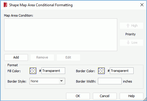
When the shape map areas are bound with data, you can add conditional formats to them, then when a specified condition is fulfilled, the format bound with the condition will be applied to the shape map areas automatically. This is very useful to highlight values that might need to be acted on by the end user.
To add conditional formats to the map areas:
 on the toolbar, or click Menu > Format > Conditional Formatting. The Shape Map Area Conditional Formatting dialog appears.
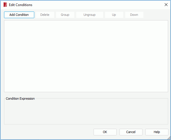
 next to the value box to specify the value of how to build the condition. You can also type in the value manually.
 To make some condition lines grouped, select them and click the Group button, then the selected condition lines will be added in one group and work as one line of filter expression. Conditions and groups together can be further grouped. To take any condition or group in a group out, select it and click Ungroup.
To adjust the priority of the condition lines, select it and click the Up or Down button.
To delete a condition line, select it and click the Delete button.
The newly added condition is then displayed in the Map Area Condition box in the Map Area Conditional Formatting dialog.
To edit a condition, select the condition from the Map Area Condition box, click the Edit button, then edit the condition in the Edit Conditions dialog.
To adjust the priority of the conditions, select a condition and click the High or Low button.
To remove a condition and the corresponding format, select the condition from the Map Area Condition box and then click the Remove button.